Region #2 - The Rocky Mountain States
•FIRST, USE A BLACK Ultra Fine Point Sharpie (or something similar)
USE These Resources to help you label! (Just click the link!)
A Physical Map of the United States
Second Physical Map of the United States
Map of Major US Rivers (scroll down)
Another Major US Rivers Map
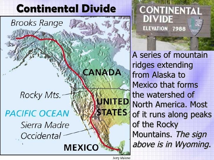
The Continental Divide
- Utah, Salt Lake City
- Colorado, Denver
- Wyoming, Cheyenne
- Nevada, Carson City
- Idaho, Boise
- Montana. Helena
- Please shade this region light brown—not too dark.
- Color blue - Rio Grande River, Snake River, Colorado River, Gila River the Great Salt Lake
- Color red - The Continental Divide - trace a line - do the best you can with it!
- Color Brown - Rocky Mountains
- shade tan or light brown - The Great Basin, the Colorado Plateau, Columbia Plateau
- After you label/color this region - shade any other areas a light green


No comments:
Post a Comment